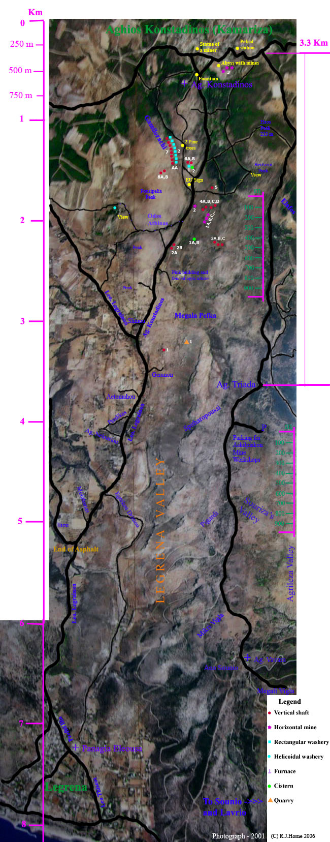
Location
Map - Legrena Valley, Lavrio, Greece
Aerial photograph file Size: 273 Kilobytes (0.273
Mb)
Minimum dial-up download time: 78 seconds at 28 Kilobits/second (2006)
You
may wish to save this photo-map to a folder to save re-downloading.
(Right-click the map and select "Save picture as" & choose a folder)
Each type of object located has been assigned a coloured symbol (see the Legend at the bottom of the map).
Each type of symbol is given a number & these numbers are assigned more or less in the order in which I located the the objects. If the objects were geographically close together they have the same number and are designated A,B,C etc. for clarity.
These
same numbers are used to identify photographs of
the objects in the corresponding photo pages.
PLEASE NOTE:
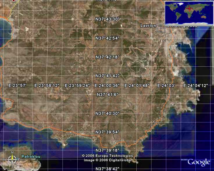
See below the old aerial photograph for the latest Google Earth satellite photograph
of the entire Lavriotiki area.
Map of the Legrena Valley with overlay indicating points of interest
The
Legrena valley can be seen laying in a straight line up the centre of the image
-
starting at Legrena and terminating at Aghios Konstadinos.
(Discovered & downloaded on 01 November 2006)